 |
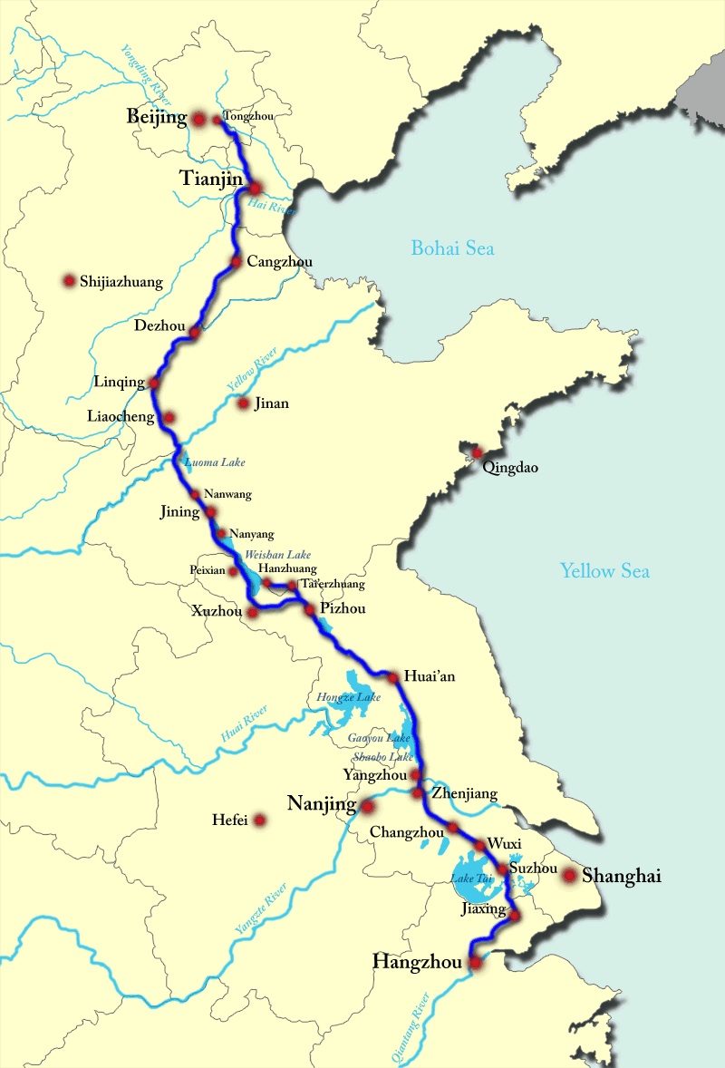
A map of the current path of the Grand canal of China
|
Liam opened his talk to a packed audience. He started by giving a brief resume of his background and why he has become so interested in
the Grand Canal of China. He first came across the canal when he was a postgraduate student studying chinese history at Fudan
University in Shanghai.
Immediately after his studies he spent some time working with the tour operator Jules Verne acting as a courier/guide on trips to China. After a short
spell away from China working for the BBC he went back to China in the role of a travel writer. Indeed he indicated that his lecture
- "The Grand Canal of China" - would be based around one of his books "The Emporer's River" with more emphasis on the engineering
aspects of the canal.
Liam stated that the Grand Canal was notable on several counts.
Firstly it is the world's oldest extant canal being in
continuous use over all or part of its length since, according to ancient records, construction started in 483 BC.
Secondly, even though
it is truncated in length at the northern end close to Beijing compared to its historical maximum length, it is still by far the world's
longest working canal currently at 1115 miles.
Liam pointed out that geographically the major rivers in China, The Yangtze and Yellow for example run predominantly
west to east but the bulk of the grain, particularly the Chinese staple food stuff - rice, is grown,to a large extent, in
the semi-tropical well watered south.
The bulk of the Chinese people live, however, in big cities along the rivers
|
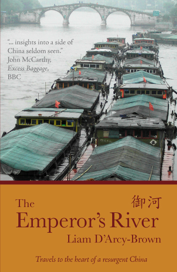
| Front cover of Liam's book
|
to the north of this growing region. Grain was important not only directly as foodstuff but also as a tax. The Emporers of the time used
to use the rice as a means of payment/bribery to members of his entourage to mainatain control and hence his personal lifestyle.
Without
this north-south waterway the grain would have to be moved either by mule train over very rough terrain or down river to the open sea,
then a potentially dangerous sea passage to a river mouth then up against the stream to the required delivery point.
The canal lies mainly in the great alluvial deltas of the chinese rivers so the height differential along the length is
not great. The peak of the Classical canal in the Shandong province is only abouy 40 metres above sea level. The bulk of the early canal
consisted of sections of excavated sections joining the natural lakes and rivers of the deltas.
Today's route in the south up to its peak dates back the seventh century whilst north from here it reflects
the movement of the Chinese capital to Beijing from Nanjing in the early fifteenth century during the later part of the Ming dynasty.
As the canal consists of a series of interconnecting man made sections there are places where it runs as part of a natural river
it can be very wide; in some places up to half a mile in navigable width! The canal was entirely build by hand using simple hand tools.
As a consequence it proved to be very costly in human life. It has been estimated that the new section from the peak
to Beijing, tne new Chinese capital in the latter part of the Ming dynasty, cost well over a million lives; the Emporer at the time was thought
to have been assinated by a military junta directly because of this loss of life.
 |
|
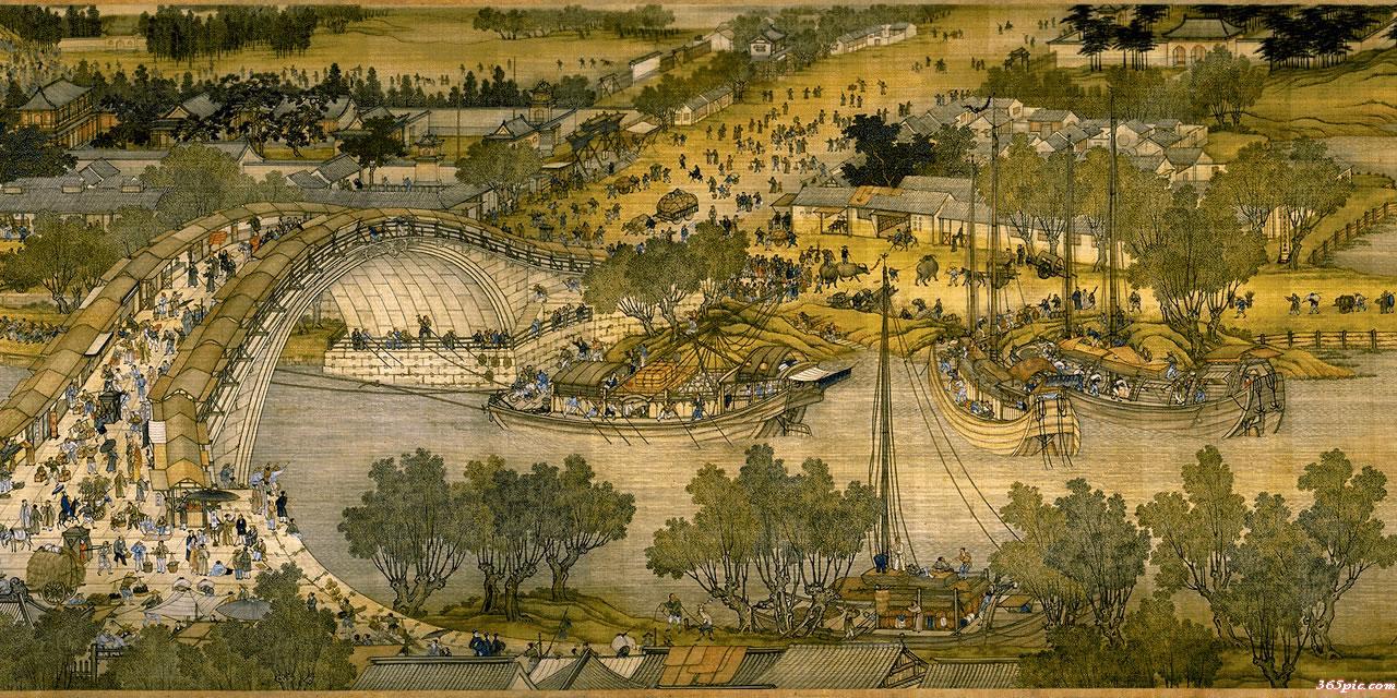
| "Going Upriver at Qingming Festival"
(12th century painting of a river connecting with the GC, to illustrate junk design)
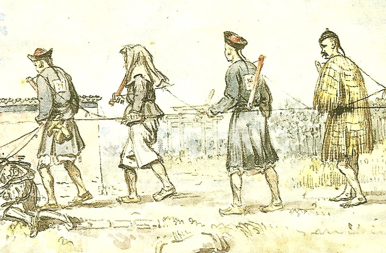
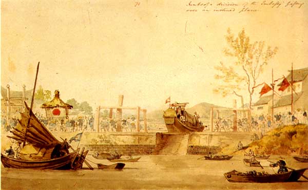
| "Trackers" pulling a barge, 1793 |
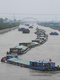
At it's height as many as 18,000 barges carried 600,000 tons of grain per year. The canal could also be used to transport men and
equipment avoiding long sea passages.
When conditions allowed wind power was used to propel the barges but in general they were towed. Unlike the later European style of towing
using either horses or cattle the barges were towed by teams of human beings known as the "Trackers". Teams could be up to a 100
strong. Again, unlike the western style canals, these canals had little or no tow-path so the "trackers" often had to wade chest
deep in water; The picture above shows a sketch made of a group of trackers by William Alexander who was one of the draughtsmen/artists
employed on one of the early British visits to China in the late eighteenth century.
 |
|
|
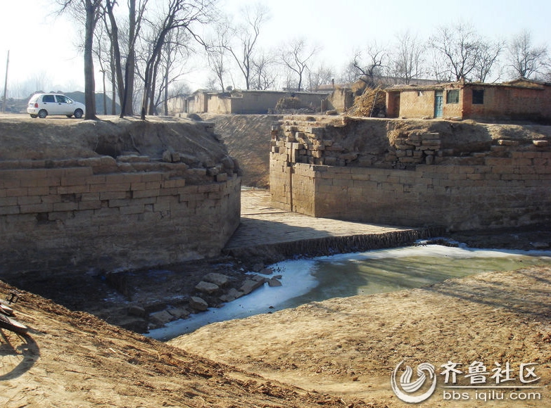
A flashlock on the route of the Grand Canal in Shandong province, recently excavated as part of the South-North
Water Transfer Project construction |
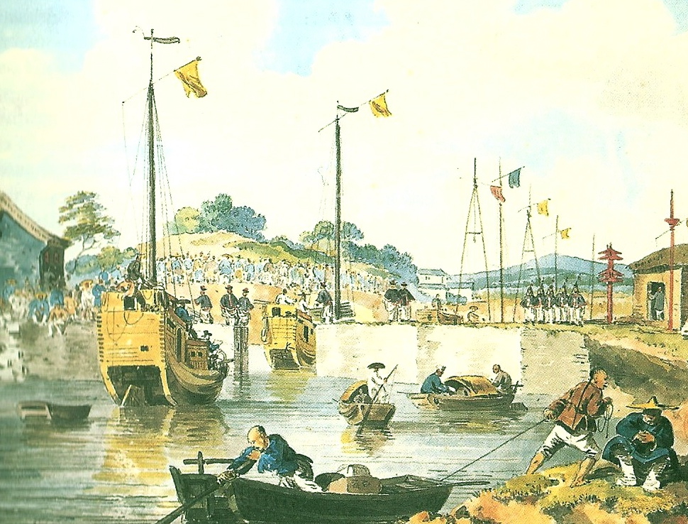
A water colour sketch of a slipway open on the Grand Canal, 1793 |
Even though it was pointed out that there was, by European standards, not much elevation change over the length of the early Grand
Canal there was sufficient to have to employ 'locking' as a means of keeping better control over barge movements. In the beginning
simple flash locks and slipways were used. The illustrations above show an example of both types of lock. Going downstream is
relatively straightforward and moving upstream is not much harder given that cheap manpower was never a problem in Imperial China.
It was only with the much steeper gradients encountered in the realignment to Beijing first attempted around in the early
twelth century that pound style locks were employed on the Grand Canal though there is much historical eveidence that these lock
types had been used on other canals in China several centuries earlier; pound locks were not used in Europe until much later.
The one advantage of pound locks is that much heavier vessels can be used with a much lower manpower usage provided an adequate water
supply is available; one of the reasons why the northern section dropped out of use about a century ago.
 |
|
| A flash lock open for traffic - water colour by William Armstrong 1793 |
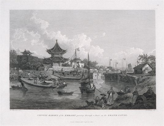
A late eighteenth century engraving by European travellers of the activity in the Grand Canal |
 |
|
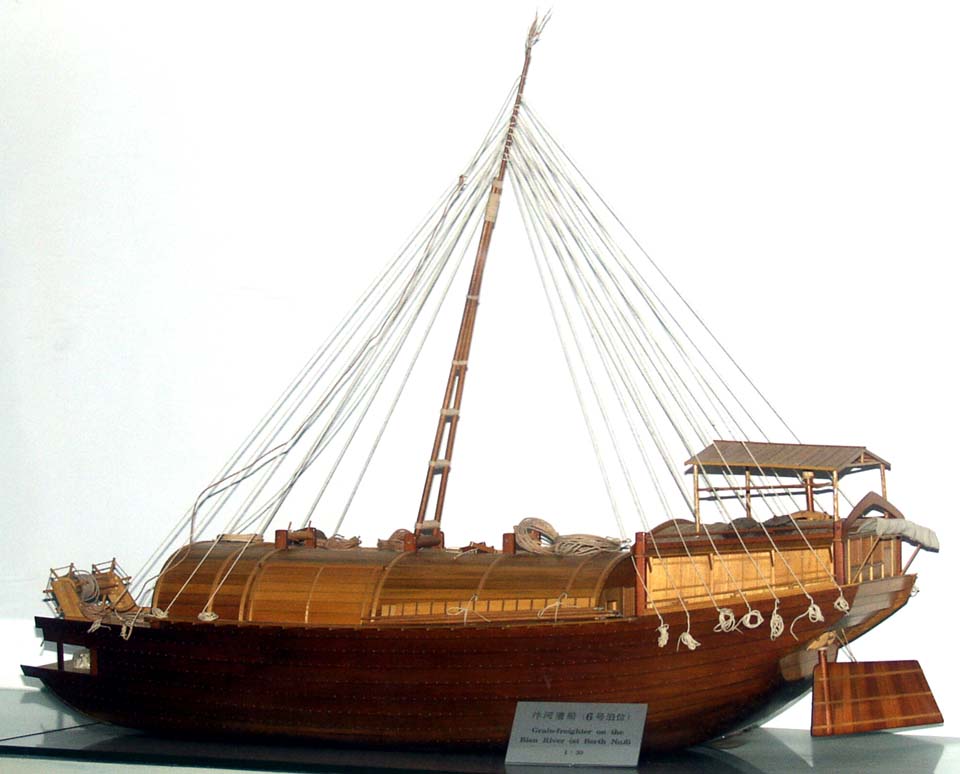
| A Tang-dynasty grain barge |
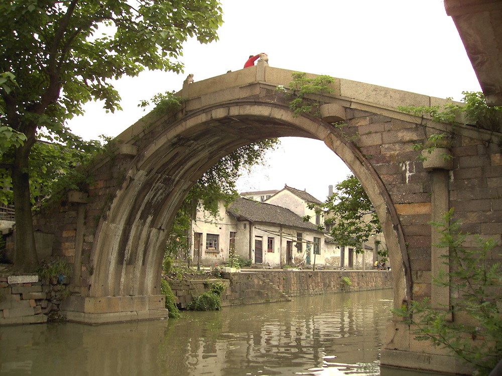
The Prefect's Bridge in Tangqi, originally late C14th, rebuilt late C19th |
The majority of the boats in the classical period were flat bottomed wooden barges with a lug sail
of the classic 'junk' shape. The flat bottom allowed the boat to navigate shallow waters and were ideally suited to
slipway and flash locks.
With the junk lug sail rigging allowed a barge could sail relatively close to the wind. From surviving early
paintings and unearthed models it is clear that the Chinese barges had stern-post rudders long before boats in the West.
The evidence also suggests that the boats had internal bulkheads with waterproof sealed cargo containers. The early barges
have been estimated to be about 20 tons in all up weight.
 |
|
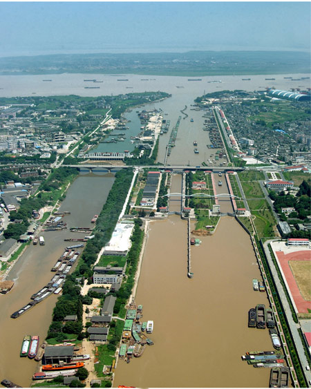
| The Yangtze shiplocks at Jianbi, on the river's S shore |
The Grand Canal a few miles north of the Yangtze |
The Grand Canal is now being promoted as a symbol of Chinese pride and
achievement.
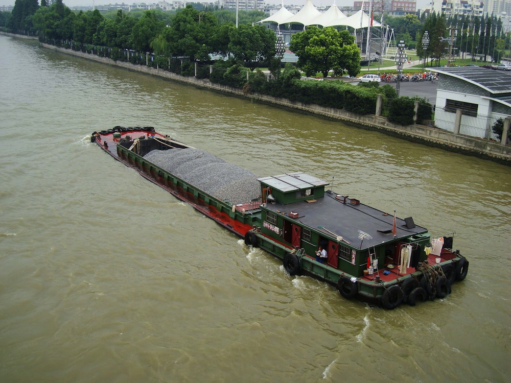
Today its 100,000 vessels carry 260 million tons of freight, mainly
coal for China's power stations and also construction materials for
growing cities like Shanghai, tarmac for motorways, and fuel.
The Canal is to become part of the South-to-North Water Transfer
Project that will carry water from the Yangtze to drought-ridden
Beijing.
 |
|
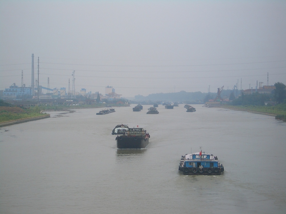
| A barge in Hangzhou |
The Grand Canal north of Wuxi, looking SE |
 |
|
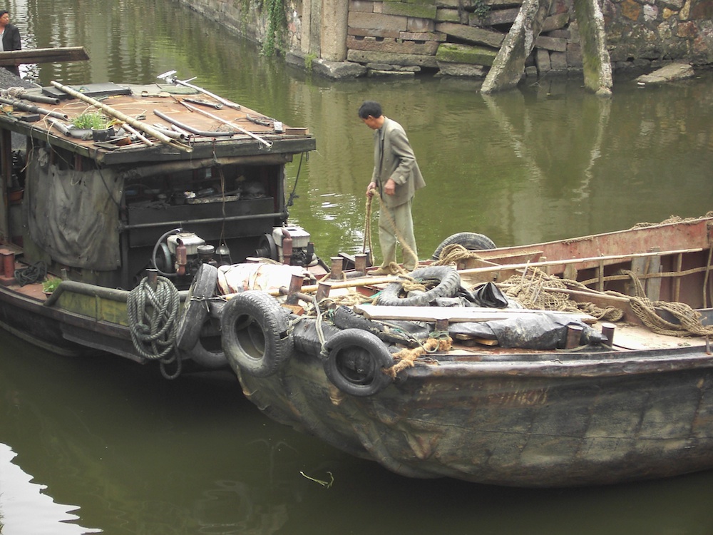
| Older-style stationary-diesel-engine barges |
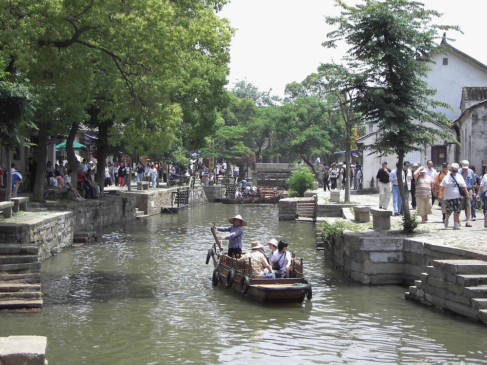
Tongli preserved historic village |
 |
|
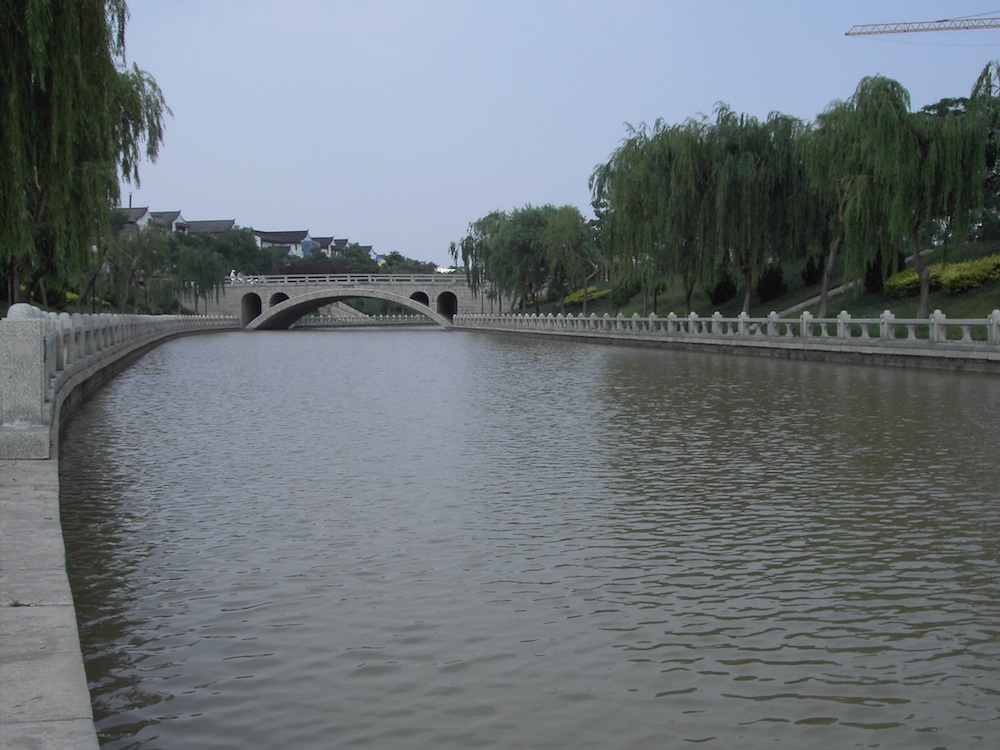
| The dredged and landscaped canal in Liaocheng, Shandong province, with a
replica of the Anji Bridge (C6th segmental arch bridge) |
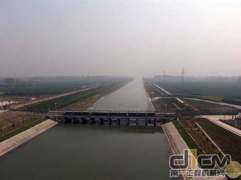
The re-engineered canal north of the Yellow River, ready to carry water
from the Yangtze to Hebei province |
Chris Hoskins December 2012